Costa Vicentina: Walking Portugal’s Protected Southwest Coast
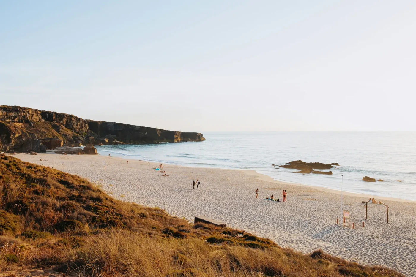
The Fishermen’s Trail runs for 226.5 km along Portugal’s southwest coast, and somewhere between 60 and 70 per cent of it is sand. It follows the paths that local people have long used to reach beaches and fishing spots, on cliffs that are, in the words of the association that maintains it, “in a constant process of erosion”. This is not a promenade, but it is the most direct way to see this coast up close.
This is the Costa Vicentina, the shorthand most visitors use for the coastline protected by the Parque Natural do Sudoeste Alentejano e Costa Vicentina. Here is what the park is, how its two coasts differ, and how to walk it in the cooler months without doing it harm.
A natural park along four municipalities
The coast was first protected in 1988 as an Área de Paisagem Protegida (protected landscape area). On 21 September 1995, Decreto Regulamentar n.º 26/95 made it a natural park. According to the Câmara Municipal de Odemira, the park covers 89,571.90 hectares: 60,577.25 ha on land and 28,991.52 ha at sea. It takes in the coastal strip of four municipalities, from north to south Sines, Odemira, Aljezur and Vila do Bispo.
The park is also part of the EU’s Natura 2000 network, as the Costa Sudoeste special area of conservation and special protection area for birds. It is now run under a co-management model created by a 2019 law. Under that model the municipalities share promotion and awareness work with the national conservation agency, ICNF, which keeps its legal powers. The co-management commission is chaired by the mayor of Odemira.
In practice, that status shapes what you will find: small villages rather than resort strips, farmland running close to the cliffs and rules on where you can walk, drive and camp. The protected area overlaps with working agriculture, villages and local businesses, and the trail association is open about how hard that balance is to keep.
Two coasts in one: dark Alentejo cliffs, pale Algarve rock
The coast changes character as you head south. The Rota Vicentina association describes high cliffs of very old, dark rock along the Alentejo stretch (schist and greywacke) and pale limestone on the Algarve side. On top of the coastal plateau sits a thin layer of sediment with its own habitats, and rivers and streams have cut deep valleys through it.
The association lists a wide range of habitats within a short distance:
- rock pools exposed at low tide, with starfish, sea urchins, barnacles and whelks;
- the dark Alentejo cliffs, where storks, falcons, swifts, jays and black redstarts nest;
- the white Algarve cliffs, with dinosaur footprints, coral fossils and caves;
- dunes with rare and endemic plants;
- estuaries and coastal plains where, in autumn, thousands of migrating birds pass through, including large soaring birds;
- temporary ponds, clear rivers where otters live, and cork and pine woods inland.
Some of these species survived the last ice age here, the association says, and their nearest populations are now hundreds of kilometres away. Others are endemic, found nowhere else. That is the reason behind many of the trail rules below.
People are part of the landscape too. In the small towns, the association notes, local traditions linked to cork, wine, honey, olive oil, tapestry, pottery and fishing are still kept up.
The Fishermen’s Trail and the Historical Way
The coast is the best-known part of a wider network. The Rota Vicentina project counts about 750 km of walking trails and over 1,000 km of cycling routes across the southwest, according to its help guide. Walkers usually choose between two long routes, or combine them.
The Fishermen’s Trail (Trilho dos Pescadores) is the coastal route. According to the official trail page:
- it has 13 one-day stages, the longest 22.5 km, and can be walked in either direction;
- it is signposted for walking without a guide, and GPS tracks can be downloaded from each stage page;
- it is a single track along the cliffs, on foot only, and the association rates it “somewhat difficult”;
- it is not recommended for people with vertigo or a fear of heights;
- groups are limited to 15 people, wild camping is not allowed, vehicles are banned from the dunes, and trail running is described as incompatible with the care the ecosystem needs.
Part of the route crosses private land. The owners allow walkers through, but only to pass on foot, and you walk at your own risk.
The Historical Way (Caminho Histórico) runs inland through villages and countryside, away from the exposed cliff edge. The association encourages walkers to combine the coast with the inland routes and circular walks, partly to spread visitors away from the busiest beaches.
Walking it in the cooler months, and walking it well
The association recommends walking the Fishermen’s Trail between September and June, so high summer falls outside its suggested season.
The months either side of winter have other advantages. Autumn is migration season over the coastal plains. The association describes winters as short and never very cold, but wet enough to green the land for the rest of the year. Days are shorter too, so plan shorter stages and earlier starts from November to February.
Be honest with yourself about the terrain. Long stretches of soft sand and cliff-top paths make the kilometres feel longer than they look on a map, and the cliffs are eroding. Keep to the marked line, away from the edge, especially in wind or after rain.
The association’s responsible travel guidance comes down to three ideas: embrace the community, protect the landscape and support local businesses. Some concrete ways to do that:
- Follow the waymarks. They were laid out to show the way and also to keep walkers off fragile habitats.
- Leave no trace, and take nothing from the dunes.
- Spend locally: book accommodation, transfers and meals with businesses in the villages you pass through. The association runs a partner network for this.
- Do not camp wild or drive onto the dunes. Use the campsites.
If you are planning a wider trip to the region, our Guides section covers the practical side of travel in Portugal, and you can find more coastal and rural destinations in Places.
Know before you go
Details as of October 2026, from the Rota Vicentina association and the Câmara Municipal de Odemira:
- Where: the coast of the Parque Natural do Sudoeste Alentejano e Costa Vicentina, across the municipalities of Sines, Odemira, Aljezur and Vila do Bispo.
- Season: the association recommends the Fishermen’s Trail from September to June.
- Cost: the association does not list a fee for walking the trails and accepts donations towards their upkeep. A paper map and guidebook are sold through its online shop.
- Getting there and around: the association says the regional public transport network does not meet most walkers’ needs and recommends the Rede Nacional de Expressos coach network instead. It warns that ticket points are not always obvious, that you sometimes need to buy tickets the day before, and that online coach timetables are only published 14 days ahead. Taxis in its partner network charge from about €1.06 per km, according to its transport page.
- Luggage: partner companies offer luggage transfers between points on the route.
- Emergencies: call 112. The association also lists the environmental police line, 808 200 520.
Check the association’s transport advice and the individual stage pages before you set out, as conditions and services change.
Sources
Sources
- Rota Vicentina: Fishermen’s Trail, consulted 2026-10-30
- Rota Vicentina: The Region, consulted 2026-10-30
- Rota Vicentina: Responsible Travel, consulted 2026-10-30
- Rota Vicentina: Help Guide, consulted 2026-10-30
- Rota Vicentina: Transports, consulted 2026-10-30
- Rota Vicentina FAQ: Can I use the existing public transport network in the region?, consulted 2026-10-30
- Câmara Municipal de Odemira: Parque Natural do Sudoeste Alentejano e Costa Vicentina, consulted 2026-10-30
- Diário da República: Decreto Regulamentar n.º 26/95, consulted 2026-10-30



1 comment